Late 2022, The Earth System Science Numerical Simulator Facility (EarthLab), a major national science and technology infrastructure project in the Period of the 12th Five-Year Plan of China, has passed state acceptance inspection and been officially put into operation. The achievement of UN sustainable development Goals (SDGs) is closely linked with disaster early warning and climate action. EarthLab is an important tool for study complex earth system. It can be used in future climate change prediction; study climate change impacts on ecological and environmental systems; probabilistic forecasts of high-impact extreme events; mitigation and adaptation strategies to climate and environmental changes.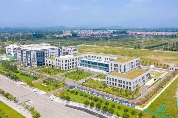
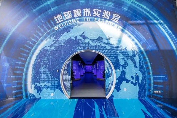
EarthLab is a numerical simulation system of the main earth systems with software and hardware. It can explore physical, chemical, and biological processes of atmosphere, hydrosphere, cryosphere, lithosphere and biosphere on the earth and their interactions, probing into the effects of these interactions on the overall earth system; merging simulated and observed data to improve the accuracy of prediction, achieving quantitative description and simulation for complex processes of the earth system under the mesoscale resolution.
The Facility consists of five systems: System I, the Numerical Earth Modelling System; System II, the High-Resolution Regional Environment Numerical Modelling System; System III, the Super Simulation Support and Management System (SSSMS); System IV, the Supporting Database, Data Assimilation, and Visualization System; and System V, the High-Performance Computing System.
The "core brain" of EarthLab is the second version of Chinese Academy of Sciences Earth System Model (CAS-ESM 2), it integrates and couples 7 subsystems including atmosphere, ocean, land surface, vegetation ecology, atmospheric chemistry, marine biochemistry, and terrestrial biochemistry. It can simulate atmosphere, hydrosphere, cryosphere, lithosphere, and biosphere, creating a relatively complete digital version of the "twin Earth".
The global model of EarthLab has a horizontal resolution of up to 10–25 km, and the spatial resolution of its regional high-precision simulation system can reach 3 km over China and 1 km over certain key areas. The peak computing power of the system will be no less than 15 trillion times per second (PFLOPS), and the total storage capacity no less than 80 PB.
EarthLab was developed by the Institute of Atmospheric physics, Sugon, Tsinghua University, and the National Satellite Meteorological Center. EarthLab is in Miyun Economic Development Zone, Eastern Cluster of Huairou Science City, Beijing. In November 2018, this construction project kicked off in full swing. In June 2021, it was initially completed. Acceptance inspection for this construction project was carried out in late 2022.